Configuring Points
Points are quite simple, they must have a name, a latitude, and a longitude, and can optionally have an expiration date. One can also associate (or disassociate) a point from a point collection.
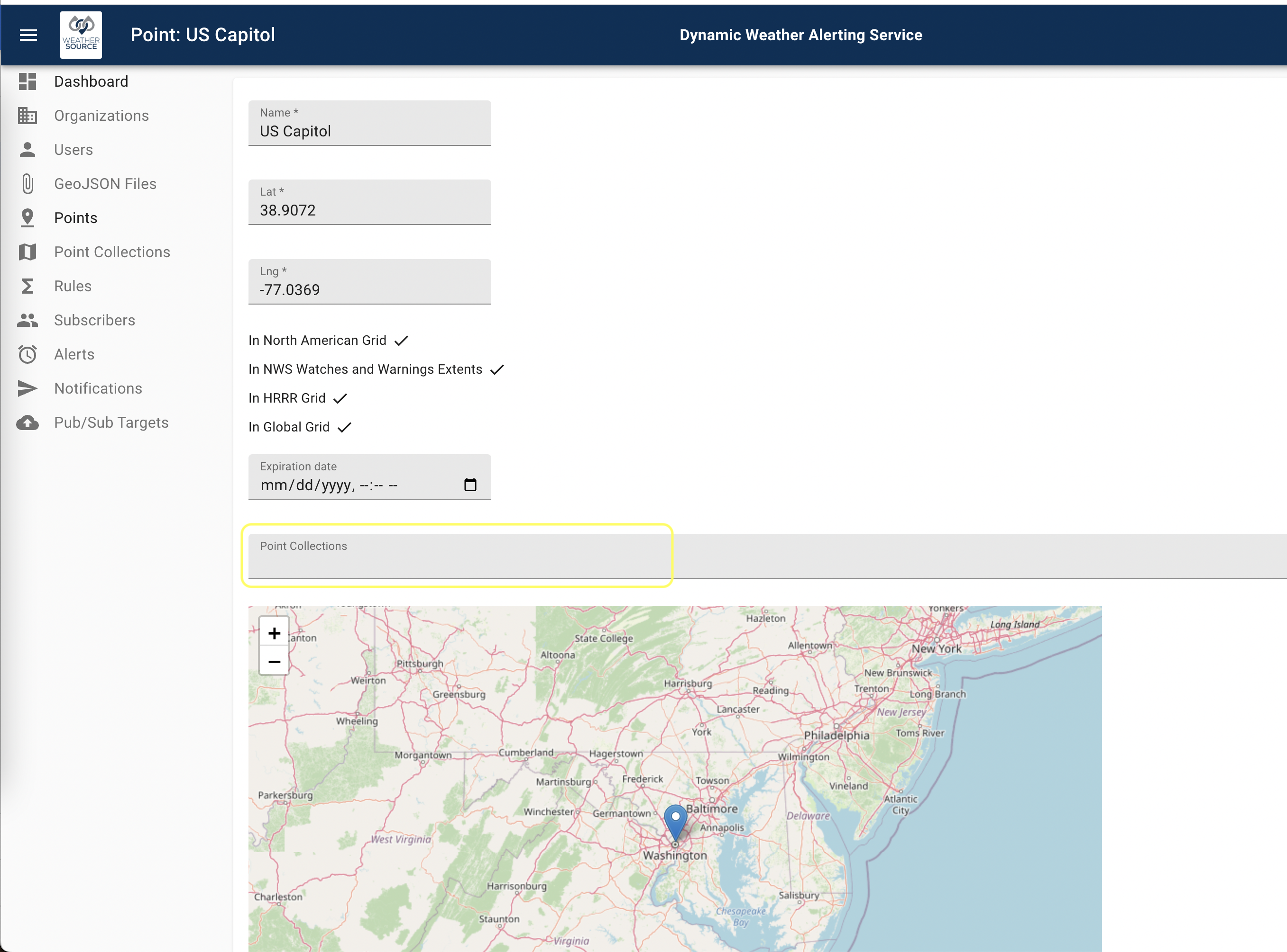
DWAS provides feedback regarding which meteorological grids a point is contained within as well as a map. These are read-only user feedback, not inputs, for quality control purposes. The interface for the U.S, Capitol is as shown below. Note that the required fields are provided and the optional ones are not.
Further, as mentioned above, note that one can associate this point with a point collection using the last dropdown available, labeled Point Collections.
As mentioned before in the section on resource limits. The DWAS system will enforce limits on the number of points in accordance with your pricing tier. You are free to adjust your pricing tier at any time. You can find more details about that in the accounting section.
Once we have some points, we can now create a point collection.